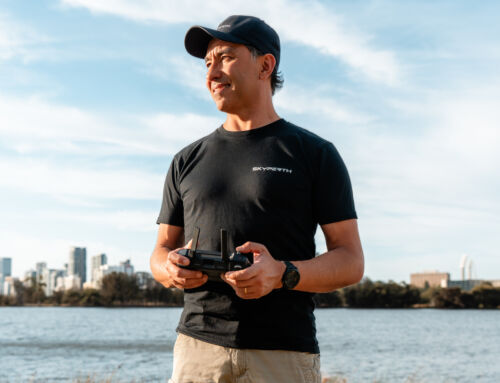
About the author : Rodrigo Branco Matsumoto

Meet Rodrigo, our chief remote pilot here at Sky Perth, where he's been transforming aerial videography into captivating stories for over eight years. At the heart of Rodrigo's work lies a profound passion for both the art of flying and the art of storytelling. This combination has led his work to be featured on platforms like Netflix, Stan, AppleTV+, Disney+, SBS On Demand, and even internationally with ZDF in Germany.
Rodrigo's aerial videography and photography journey is a testament to his dedication to mastering this unique craft. From capturing the vast beauty of Australia's landscapes to the dynamic energy of urban life across the globe, his work offers viewers a fresh, sky-high perspective. It's not just about the technical expertise of handling a drone; for Rodrigo, every flight is an opportunity to tell a story, to reveal the unseen, and to share a new viewpoint with the world.
Renowned for his collaborative spirit and innovative approach, Rodrigo brings more than technical skills to every project at Sky Perth. Whether working on a documentary, a TV series, or a bespoke project, his focus remains on creating visuals that resonate deeply with audiences. His commitment to quality and ability to capture the heart of a story make him a skilled pilot and a storyteller of the skies.
Do you want to know more about Rodrigo? Check his website: rodmatsumoto.com
The Evolution of Aerial Imaging
The world of aerial imaging has seen significant evolution in recent years. Initially captured using small-scale platforms like model aircraft and lightweight video cameras, aerial imaging has been revolutionised by technology development. Innovations include ready-to-fly (RTF) devices, low-cost digital cameras, image processing, GPS, thermal, multispectral, hyperspectral, and LiDAR sensors. Uncrewed Aerial Vehicles (UAVs) have become a sophisticated means of acquiring high-resolution photographic and 4K video datasets for small-area coverage studies.
GPS: A Crucial Tool for Precision
Aerial imaging uses GPS for precise location, providing invaluable data for agriculture and energy management sectors. Farmers, for instance, use GPS targeting for crop health monitoring and accurate fertiliser application.
Aerial Imaging During the COVID-19 Pandemic
The COVID-19 pandemic further emphasised the importance of aerial imaging. It has been used for tasks from studying the economic impact of the virus to remote monitoring of infrastructure and facilities. The technology has even played a crucial role in surveying and mapping areas for hospitals and COVID-19 test centres.
A Growing Trend in the Construction Industry
The construction industry is another sector where aerial imaging is projected to grow significantly. High-resolution images and topographic information obtained through drones or UAVs assist builders in surveying sites, estimating project costs, and managing time effectively. Aerial imaging is a cost-effective tool that helps manage construction projects from planning to completion, keeping timelines on track and staying within budget.
Global Landscape: North America in the Lead
Internationally, North America is a significant player in the aerial imaging market due to high research and technology adoption levels. Aerial imaging is used for everything from land mapping and development to disaster and emergency response management. The industry is expected to grow further due to increasing government spending on the construction industry and technological advancements.
Innovation and Competition in the Market
The market is competitive, with companies providing aerial imagery or solutions based on the imagery. Notable developments include the launch of eBee TAC, a fixed-wing Unmanned Aircraft System (UAS) designed for covert tactical mapping operations by senseFly, and Nearmap’s post-catastrophe aerial imagery program for property and casualty insurance carriers.
The Australian Market: A Look Down Under
Focusing on Australia, the country is a significant player in the Asia-Pacific region’s aerial imaging market, which is projected to reach USD 1.8 billion by 2024. Australia’s drone market itself is expected to grow to USD 92.4 million by 2024.
Further data on the specifics of Australia’s aerial imaging market could not be obtained now, but the upward trend in the Asia-Pacific region suggests a promising future for aerial imaging in Australia.